
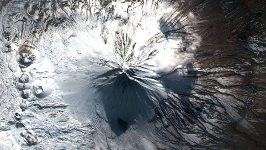
The Ministry of National Defense (MSB) shared the photo of Mount Ararat taken by the Göktürk-2B satellite. In the post made on the ministry’s NSosyal account, it was stated that the Göktürk-2B satellite has made 16 thousand 100 tours around the world at an altitude of 680 kilometers for 3 years since the day it started its duty and captured 8 million 485 thousand square kilometers of images with sub-meter resolution.
In the post, the following was noted: “3 years of uninterrupted mission from the summit to space. A view of Turkey’s peak, Mount Ararat, from space. On the 3rd anniversary of the launch of our Göktürk-2B satellite from Vandenberg Space Force Base (USA) on April 15, 2023, it salutes the highest point of Anatolia from space. Our satellite, under the command control of the Reconnaissance Satellite Battalion Command personnel of the Air Force Space Command, is in space in a mission field extending all over the world.” “It continues to be the symbol of our strong existence, beyond the sky, on the trail of the homeland.” The post also included a photo of Mount Ararat taken by the Göktürk-2B satellite.
Source: AA


Comments
You can write your views about this story. Comments may be moderated according to site settings.